Weather Alert in California
Winter Storm Watch issued February 15 at 11:19PM PST until February 18 at 4:00AM PST by NWS Las Vegas NV
AREAS AFFECTED: Owens Valley
DESCRIPTION: * WHAT...Heavy snow possible. Total snow accumulations of 3 to 6 inches, mainly north of Lone Pine. Winds could gust as high as 40 mph. * WHERE...Owens Valley. * WHEN...From Tuesday morning through late Tuesday night. * IMPACTS...Slick and snow-covered roadways will quickly become dangerous with numerous slide-offs and spin-outs possible. * ADDITIONAL DETAILS...Snowfall is expected to develop by Tuesday afternoon with the snow level hovering near the valley floor. Colder air will move in after dark with increasing snow intensity expected and roadways becoming dangerous.
INSTRUCTION: Persons should delay all travel if possible. If travel is absolutely necessary, drive with extreme caution and be prepared for sudden changes in visibility. Leave plenty of room between you and the motorist ahead of you, and allow extra time to reach your destination. Avoid sudden braking or acceleration, and be especially cautious on hills or when making turns. Make sure your car is winterized and in good working order.
Want more detail? Get the Complete 7 Day and Night Detailed Forecast!
Current U.S. National Radar--Current
The Current National Weather Radar is shown below with a UTC Time (subtract 5 hours from UTC to get Eastern Time).

National Weather Forecast--Current
The Current National Weather Forecast and National Weather Map are shown below.

National Weather Forecast for Tomorrow
Tomorrow National Weather Forecast and Tomorrow National Weather Map are show below.

North America Water Vapor (Moisture)
This map shows recent moisture content over North America. Bright and colored areas show high moisture (ie, clouds); brown indicates very little moisture present; black indicates no moisture.

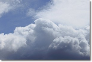
Weather Topic: What are Nimbostratus Clouds?
Home - Education - Cloud Types - Nimbostratus Clouds
 Next Topic: Precipitation
A nimbostratus cloud is similar to a stratus cloud in its formless,
smooth appearance. However, a nimbostratus cloud is darker than a stratus cloud,
because it is thicker.
Unlike a stratus cloud, a nimbostratus cloud typically brings with it the threat
of moderate to heavy precipitation. In some cases, the precipitation may evaporate
before reaching the ground, a phenomenon known as virga.
Next Topic: Precipitation
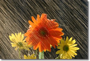
Weather Topic: What is Rain?
Home - Education - Precipitation - Rain
 Next Topic: Shelf Clouds
Precipitation in the form of water droplets is called rain.
Rain generally has a tendency to fall with less intensity over a greater period
of time, and when rainfall is more severe it is usually less sustained.
Rain is the most common form of precipitation and happens with greater frequency
depending on the season and regional influences. Cities have been shown to have
an observable effect on rainfall, due to an effect called the urban heat island.
Compared to upwind, monthly rainfall between twenty and forty miles downwind of
cities is 30% greater.
Next Topic: Shelf Clouds
Current conditions powered by WeatherAPI.com


