Weather Alert in Minnesota
Winter Storm Watch issued February 16 at 2:05AM CST until February 19 at 12:00PM CST by NWS Duluth MN
AREAS AFFECTED: Southern Lake/North Shore; Southern Cook/North Shore
DESCRIPTION: * WHAT...Blizzard conditions possible. Total snow accumulations between 10 and 15 inches and ice accumulations around one tenth of an inch possible. Winds could gust as high as 50 mph. * WHERE...Southern Cook and Southern Lake Counties. This includes the Tribal Lands of the Grand Portage Reservation. * WHEN...From Tuesday evening through Thursday morning. * IMPACTS...Visibilities may drop below 1/4 mile due to falling and blowing snow. Travel could be very difficult to impossible. Areas of blowing snow could significantly reduce visibility. The hazardous conditions could impact the Wednesday morning and evening commutes. Strong winds could cause tree damage. * ADDITIONAL DETAILS...Expect terrain and lake enhancement to snowfall totals and snowfall rates. The heaviest snowfall rates will be Tuesday night and Wednesday morning. Winds will be strongest Tuesday evening into Wednesday morning. The best potential for a wintry mix will be along and southwest of Silver Bay Tuesday evening into Wednesday morning.
INSTRUCTION: Prepare for possible blizzard conditions. Continue to monitor the latest forecasts for updates on this situation. Prepare for possible blizzard conditions, especially whiteout conditions along Highway 61 on the North Shore. Continue to monitor the latest forecasts for updates on this situation.
Want more detail? Get the Complete 7 Day and Night Detailed Forecast!
Current U.S. National Radar--Current
The Current National Weather Radar is shown below with a UTC Time (subtract 5 hours from UTC to get Eastern Time).

National Weather Forecast--Current
The Current National Weather Forecast and National Weather Map are shown below.

National Weather Forecast for Tomorrow
Tomorrow National Weather Forecast and Tomorrow National Weather Map are show below.

North America Water Vapor (Moisture)
This map shows recent moisture content over North America. Bright and colored areas show high moisture (ie, clouds); brown indicates very little moisture present; black indicates no moisture.

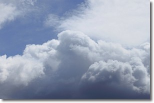
Weather Topic: What are Nimbostratus Clouds?
Home - Education - Cloud Types - Nimbostratus Clouds
 Next Topic: Precipitation
A nimbostratus cloud is similar to a stratus cloud in its formless,
smooth appearance. However, a nimbostratus cloud is darker than a stratus cloud,
because it is thicker.
Unlike a stratus cloud, a nimbostratus cloud typically brings with it the threat
of moderate to heavy precipitation. In some cases, the precipitation may evaporate
before reaching the ground, a phenomenon known as virga.
Next Topic: Precipitation
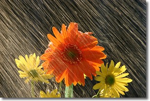
Weather Topic: What is Rain?
Home - Education - Precipitation - Rain
 Next Topic: Shelf Clouds
Precipitation in the form of water droplets is called rain.
Rain generally has a tendency to fall with less intensity over a greater period
of time, and when rainfall is more severe it is usually less sustained.
Rain is the most common form of precipitation and happens with greater frequency
depending on the season and regional influences. Cities have been shown to have
an observable effect on rainfall, due to an effect called the urban heat island.
Compared to upwind, monthly rainfall between twenty and forty miles downwind of
cities is 30% greater.
Next Topic: Shelf Clouds
Current conditions powered by WeatherAPI.com


