Weather Alert in Iowa
Winter Weather Advisory issued February 28 at 7:31AM CST until February 28 at 9:00PM CST by NWS La Crosse WI
AREAS AFFECTED: Howard; Winneshiek; Allamakee; Wabasha; Dodge; Olmsted; Winona; Mower; Fillmore; Houston; La Crosse; Monroe; Juneau; Adams; Vernon; Crawford; Richland
DESCRIPTION: ...A NARROW BAND OF SNOW TODAY... .A narrow band of snow will move in from the west this morning and then continue into late this afternoon or evening. Snowfall rates up to an inch per hour will be possible mainly from the late morning through the early afternoon where the narrow heavy snowfall band sets up, quickly accumulating on roadways. Snowfall amounts within the band will likely range between 2 to 4 inches with locally higher amounts possible (30%). A sharp cutoff in snowfall amounts to the north and south is expected. Therefore, any slight shift in storm track can still affect snowfall location and local impacts. As a result, be sure to continue to monitor the forecast for updates. * WHAT...Snow. Additional snow accumulations between 1 and 4 inches. Locally higher amounts will be possible. * WHERE...Portions of northeast Iowa, southeast Minnesota, and central, southwest, and west central Wisconsin. * WHEN...Until 9 PM CST this evening. * IMPACTS...Plan on slippery road conditions.
INSTRUCTION: Slow down and use caution while traveling. In Iowa, visit 511ia.org for road conditions. In Minnesota, visit 511mn.org for road conditions. In Wisconsin, visit 511wi.gov for road conditions.
Want more detail? Get the Complete 7 Day and Night Detailed Forecast!
Current U.S. National Radar--Current
The Current National Weather Radar is shown below with a UTC Time (subtract 5 hours from UTC to get Eastern Time).

National Weather Forecast--Current
The Current National Weather Forecast and National Weather Map are shown below.

National Weather Forecast for Tomorrow
Tomorrow National Weather Forecast and Tomorrow National Weather Map are show below.

North America Water Vapor (Moisture)
This map shows recent moisture content over North America. Bright and colored areas show high moisture (ie, clouds); brown indicates very little moisture present; black indicates no moisture.

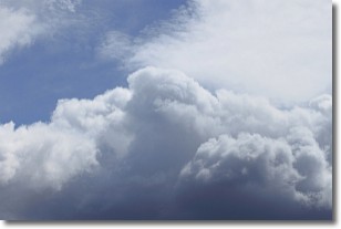
Weather Topic: What are Nimbostratus Clouds?
Home - Education - Cloud Types - Nimbostratus Clouds
 Next Topic: Precipitation
A nimbostratus cloud is similar to a stratus cloud in its formless,
smooth appearance. However, a nimbostratus cloud is darker than a stratus cloud,
because it is thicker.
Unlike a stratus cloud, a nimbostratus cloud typically brings with it the threat
of moderate to heavy precipitation. In some cases, the precipitation may evaporate
before reaching the ground, a phenomenon known as virga.
Next Topic: Precipitation
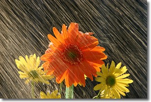
Weather Topic: What is Rain?
Home - Education - Precipitation - Rain
 Next Topic: Shelf Clouds
Precipitation in the form of water droplets is called rain.
Rain generally has a tendency to fall with less intensity over a greater period
of time, and when rainfall is more severe it is usually less sustained.
Rain is the most common form of precipitation and happens with greater frequency
depending on the season and regional influences. Cities have been shown to have
an observable effect on rainfall, due to an effect called the urban heat island.
Compared to upwind, monthly rainfall between twenty and forty miles downwind of
cities is 30% greater.
Next Topic: Shelf Clouds
Current conditions powered by WeatherAPI.com


