Weather Alert in California
Flash Flood Warning issued February 16 at 10:23AM PST until February 16 at 2:00PM PST by NWS Los Angeles/Oxnard CA
AREAS AFFECTED: Los Angeles, CA
DESCRIPTION: FFWLOX The National Weather Service in Los Angeles/Oxnard has issued a * Flash Flood Warning for... The Santa Monica Mountains... Including the Palisades and Franklin Burn Scars... And Surrounding Areas of Southwestern Los Angeles County in southwestern California. * Until 200 PM PST. * At 1023 AM PST, Doppler radar indicated heavy rain across the warned area. The expected rainfall rate is 0.5 to 1 inch in 1 hour. Flash flooding is ongoing or expected to begin shortly. HAZARD...Flash flooding caused by heavy rain. Rock and mud slides. Minor debris flows. SOURCE...Radar. IMPACT...Flash flooding of small creeks and streams, urban areas, highways, streets and underpasses as well as other poor drainage and low-lying areas. Rock and mud slides. Minor debris flows. * Some locations that will experience flash flooding include... Thousand Oaks, Malibu, Woodland Hills, Encino, Santa Monica, Agoura Hills, Beverly Hills, North Hollywood, Hollywood, Universal City, Burbank, Griffith Park, Topanga State Park, Pacific Palisades, Calabasas, Brentwood, Malibu Creek State Park, Interstate 405 through the Sepulveda Pass and Bel Air. This also includes the Palisades and Franklin Burn Scars.
INSTRUCTION: Turn around, don't drown when encountering flooded roads. Most flood deaths occur in vehicles. Be aware of your surroundings and do not drive on flooded roads, and be aware of rock slides and mud slides around high terrain. Follow direction of Emergency Management and Law Enforcement officials.
Want more detail? Get the Complete 7 Day and Night Detailed Forecast!
Current U.S. National Radar--Current
The Current National Weather Radar is shown below with a UTC Time (subtract 5 hours from UTC to get Eastern Time).

National Weather Forecast--Current
The Current National Weather Forecast and National Weather Map are shown below.

National Weather Forecast for Tomorrow
Tomorrow National Weather Forecast and Tomorrow National Weather Map are show below.

North America Water Vapor (Moisture)
This map shows recent moisture content over North America. Bright and colored areas show high moisture (ie, clouds); brown indicates very little moisture present; black indicates no moisture.

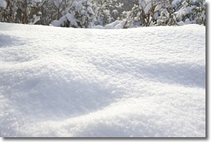
Weather Topic: What is Snow?
Home - Education - Precipitation - Snow
 Next Topic: Stratocumulus Clouds
Snow is precipitation taking the form of ice crystals. Each ice crystal, or snowflake,
has unique characteristics, but all of them grow in a hexagonal structure.
Snowfall can last for sustained periods of time and result in significant buildup
of snow on the ground.
On the earth's surface, snow starts out light and powdery, but as it begins to melt
it tends to become more granular, producing small bits of ice which have the consistency of
sand. After several cycles of melting and freezing, snow can become very dense
and ice-like, commonly known as snow pack.
Next Topic: Stratocumulus Clouds
Weather Topic: What are Stratus Clouds?
Home - Education - Cloud Types - Stratus Clouds
 Next Topic: Wall Clouds
Stratus clouds are similar to altostratus clouds, but form at a
lower altitude and are identified by their fog-like appearance, lacking the
distinguishing features of most clouds.
Stratus clouds are wider than most clouds, and their base has a smooth, uniform
look which is lighter in color than a nimbostratus cloud.
The presence of a stratus cloud indicates the possibility of minor precipitation,
such as drizzle, but heavier precipitation does not typically arrive in the form
of a stratus cloud.
Next Topic: Wall Clouds
Current conditions powered by WeatherAPI.com


