Weather Alert in Oklahoma
Flood Warning issued August 27 at 2:16PM CDT until August 29 at 8:12PM CDT by NWS Tulsa OK
AREAS AFFECTED: Adair, OK; Cherokee, OK; Delaware, OK
DESCRIPTION: ...The National Weather Service in Tulsa OK has issued a Flood Warning for the following rivers in Oklahoma... Illinois River near Watts affecting Delaware and Adair Counties. Illinois River at Chewey affecting Delaware, Adair and Cherokee Counties. Illinois River near Tahlequah affecting Cherokee County. * WHAT...Minor flooding is forecast. * WHERE...Illinois River at Chewey. * WHEN...From Friday afternoon to Friday evening. * IMPACTS...At 12.0 feet, minor flooding occurs from near Fidler's Bend to near Hanging Rock. Road access near the river to residential homes southeast of Chewey Bridge may be compromised. Water begins to impact 630 Road east of the Cherokee/Adair County line. Floating the river is too hazardous due to strong turbulence. * ADDITIONAL DETAILS... - At 1:15 PM CDT Wednesday the stage was 2.9 feet. - Forecast...The river is expected to rise to a crest of 12.1 feet early Friday afternoon. It will then fall below flood stage by early Friday evening. - Flood stage is 12.0 feet. - http://www.weather.gov/safety/flood
INSTRUCTION: N/A
Want more detail? Get the Complete 7 Day and Night Detailed Forecast!
Current U.S. National Radar--Current
The Current National Weather Radar is shown below with a UTC Time (subtract 5 hours from UTC to get Eastern Time).

National Weather Forecast--Current
The Current National Weather Forecast and National Weather Map are shown below.

National Weather Forecast for Tomorrow
Tomorrow National Weather Forecast and Tomorrow National Weather Map are show below.

North America Water Vapor (Moisture)
This map shows recent moisture content over North America. Bright and colored areas show high moisture (ie, clouds); brown indicates very little moisture present; black indicates no moisture.

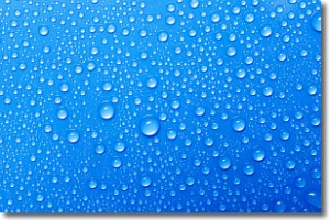
Weather Topic: What is Condensation?
Home - Education - Precipitation - Condensation
 Next Topic: Contrails
Condensation is the process which creates clouds, and therefore
it is a crucial process in the water cycle.
Condensation is the change of matter from a state of gas into a state of liquid,
and it happens because water molecules release heat into the atmosphere and
become organized into a more closely packed structure, what we might see as
water droplets.
Water is always present in the air around us as a vapor, but it's too small for
us to see. When water undergoes the process of condensation it becomes organized
into visible water droplets. You've probably seen condensation happen before on the
surface of a cold drink!
Next Topic: Contrails
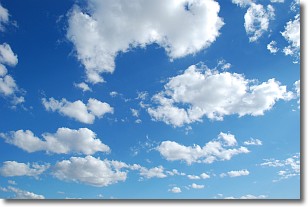
Weather Topic: What are Cumulonimbus Clouds?
Home - Education - Cloud Types - Cumulonimbus Clouds
 Next Topic: Cumulus Clouds
The final form taken by a growing cumulus cloud is the
cumulonimbus cloud, which is very tall and dense.
The tower of a cumulonimbus cloud can soar 23 km into the atmosphere, although
most commonly they stop growing at an altitude of 6 km.
Even small cumulonimbus clouds appear very large in comparison to other cloud types.
They can signal the approach of stormy weather, such as thunderstorms or blizzards.
Next Topic: Cumulus Clouds
Current conditions powered by WeatherAPI.com


