Weather Alert in California
Winter Storm Warning issued February 16 at 4:21AM PST until February 19 at 10:00AM PST by NWS Medford OR
AREAS AFFECTED: Western Siskiyou County
DESCRIPTION: * WHAT...Heavy snow expected above 5000 ft through this morning with accumulations of 4 to 8 inches expected. After a brief lull in precipitation this afternoon, snow levels drop to around 1000-1500 ft tonight into Tuesday, and remain low through Thursday. Additional snow accumulations 6 to 12 inches are expected with 2 to 3 ft expected above 5000 ft. Winds gusting as high as 40 mph over high and exposed terrain. * WHERE...In western Siskiyou County, elevations above 5000 ft through Monday morning, lowering all areas Monday evening. This includes all of Highway 96 and 3, and Etna Summit on Sawyers Bar Rd. This also now includes the Klamath River and Scott Valleys, the communities of Happy Camp, Somes Bar, Etna, Greenview, and Callahan. * WHEN...Until 10 AM PST Thursday. * IMPACTS...Travel may be very difficult to impossible. The hazardous conditions could impact the Monday morning and evening commutes. * ADDITIONAL DETAILS...The heaviest snow is expected late tonight into Tuesday morning. Visit weather.gov/mfr/winter for snow probabilities.
INSTRUCTION: If you must travel, keep an extra flashlight, food, and water in your vehicle in case of an emergency. Call 511 or visit quickmap.dot.ca.gov for road information.
Want more detail? Get the Complete 7 Day and Night Detailed Forecast!
Current U.S. National Radar--Current
The Current National Weather Radar is shown below with a UTC Time (subtract 5 hours from UTC to get Eastern Time).

National Weather Forecast--Current
The Current National Weather Forecast and National Weather Map are shown below.

National Weather Forecast for Tomorrow
Tomorrow National Weather Forecast and Tomorrow National Weather Map are show below.

North America Water Vapor (Moisture)
This map shows recent moisture content over North America. Bright and colored areas show high moisture (ie, clouds); brown indicates very little moisture present; black indicates no moisture.

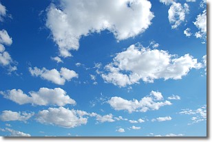
Weather Topic: What are Cumulonimbus Clouds?
Home - Education - Cloud Types - Cumulonimbus Clouds
 Next Topic: Cumulus Clouds
The final form taken by a growing cumulus cloud is the
cumulonimbus cloud, which is very tall and dense.
The tower of a cumulonimbus cloud can soar 23 km into the atmosphere, although
most commonly they stop growing at an altitude of 6 km.
Even small cumulonimbus clouds appear very large in comparison to other cloud types.
They can signal the approach of stormy weather, such as thunderstorms or blizzards.
Next Topic: Cumulus Clouds
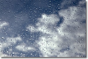
Weather Topic: What is Drizzle?
Home - Education - Precipitation - Drizzle
 Next Topic: Evaporation
Drizzle is precipitation in the form of water droplets which are
smaller than raindrops.
Drizzle is characterized by fine, gently falling droplets and typically does not
impact human habitation in a negative way. The exception to this is freezing drizzle,
a condition where drizzle freezes immediately upon reaching earth's surface.
Freezing drizzle is still less dangerous than freezing rain, but can
potentially result in hazardous road conditions.
Next Topic: Evaporation
Current conditions powered by WeatherAPI.com


