Weather Alert in California
Winter Weather Advisory issued February 16 at 4:21AM PST until February 19 at 10:00AM PST by NWS Medford OR
AREAS AFFECTED: Northeast Siskiyou and Northwest Modoc Counties; Modoc County; Klamath Basin; Northern and Eastern Klamath County and Western Lake County; Central and Eastern Lake County
DESCRIPTION: * WHAT...Snow expected. Total snow accumulations 2 to 6 inches, with 6 to 10 inches expected across the Modoc, along Highway 97 north of Chiloquin and the higher terrain of the Warners. Winds gusting as high as 40 mph over high and exposed terrain. * WHERE...Klamath Basin and Winter Rim in Klamath county and Lake County, Northeast Siskiyou and Northwest Modoc Counties, and Modoc County. Including the locations of...Dorris, Macdoel, Tulelake, Adin, Alturas, Canby, Day, Likely, Klamath Falls, Olene, Chemult, Crescent, Beatty, Bly, Sprague River, Adel, Fort Rock, Lakeview, Valley Falls, Paisley. This also includes the following passes or notable locations... Cedar Pass on state highway 239 at 6323 ft. Warner Mountain Summit on state highway 140 at 5850 ft. * WHEN...From 4 AM Tuesday to 10 AM PST Thursday. * IMPACTS...Travel may be very difficult to impossible. The hazardous conditions could impact the Tuesday morning and evening commutes. Gusty winds could bring down tree branches. * ADDITIONAL DETAILS...The heaviest snow is expected tonight into early Tuesday morning. Visit weather.gov/mfr/winter for snow probabilities.
INSTRUCTION: Slow down and use caution while traveling. In California, call 511 or visit quickmap.dot.ca.gov for road information. In Oregon, call 511 or visit tripcheck.com for road information.
Want more detail? Get the Complete 7 Day and Night Detailed Forecast!
Current U.S. National Radar--Current
The Current National Weather Radar is shown below with a UTC Time (subtract 5 hours from UTC to get Eastern Time).

National Weather Forecast--Current
The Current National Weather Forecast and National Weather Map are shown below.

National Weather Forecast for Tomorrow
Tomorrow National Weather Forecast and Tomorrow National Weather Map are show below.

North America Water Vapor (Moisture)
This map shows recent moisture content over North America. Bright and colored areas show high moisture (ie, clouds); brown indicates very little moisture present; black indicates no moisture.

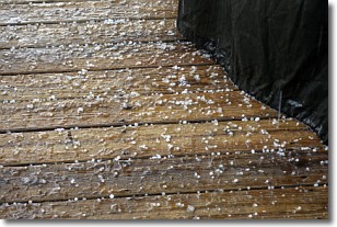
Weather Topic: What is Sleet?
Home - Education - Precipitation - Sleet
 Next Topic: Snow
Sleet is a form of precipitation in which small ice pellets are the primary
components. These ice pellets are smaller and more translucent than hailstones,
and harder than graupel. Sleet is caused by specific atmospheric conditions and
therefore typically doesn't last for extended periods of time.
The condition which leads to sleet formation requires a warmer body of air to be
wedged in between two sub-freezing bodies of air. When snow falls through a warmer
layer of air it melts, and as it falls through the next sub-freezing body of air
it freezes again, forming ice pellets known as sleet. In some cases, water
droplets don't have time to freeze before reaching the surface and the result is
freezing rain.
Next Topic: Snow
Weather Topic: What are Stratocumulus Clouds?
Home - Education - Cloud Types - Stratocumulus Clouds
 Next Topic: Stratus Clouds
Stratocumulus clouds are similar to altocumulus clouds in their
fluffy appearance, but have a slightly darker shade due to their additional mass.
A good way to distinguish the two cloud types is to hold your hand out and measure
the size of an individual cloud; if it is the size of your thumb it is generally
an altocumulus cloud, if it is the size of your hand it is generally a
stratocumulus cloud.
It is uncommon for stratocumulus clouds to produce precipitation, but if they do
it is usually a light rain or snow.
Next Topic: Stratus Clouds
Current conditions powered by WeatherAPI.com


