Weather Alert in Hawaii
Wind Advisory issued February 8 at 4:04AM HST until February 8 at 6:00AM HST by NWS Honolulu HI
AREAS AFFECTED: Niihau; Oahu North Shore; Olomana; Maui Windward West; Kauai North; Kauai East; East Honolulu; Koolau Windward; Molokai Windward; Molokai Southeast; Molokai North; Windward Haleakala; Kipahulu; South Maui/Upcountry; South Haleakala; Big Island South; Big Island Southeast; Big Island North
DESCRIPTION: * WHAT...For the Wind Advisory, northeast winds 20 to 30 mph with gusts to around 50 mph. For the High Wind Warning, northeast winds 25 to 35 mph with gusts up to 60 mph are expected. * WHERE...All Hawaiian Islands. * WHEN...For the Wind Advisory, until 6 AM HST early this morning. For the High Wind Warning, until 6 PM HST Monday. * IMPACTS...Damaging winds may blow down trees and power lines and damage roofs. Power outages are possible. Travel will be difficult, especially for high profile vehicles. Winds this strong can tear off shingles, knock down tree branches, blow away tents and awnings and make it difficult to steer, especially for drivers of high profile vehicles.
INSTRUCTION: Strong winds may lead to property damage. Hazardous driving conditions due to powerful cross winds will pose a serious risk for drivers, especially for light weight and high profile vehicles. Loose outdoor items should be brought inside or secured properly. A High Wind Warning means that winds are expected to be at least 40 mph, with gusts over 60 mph. Stay away from downed power lines. Watch out for falling tree branches when walking or driving. Make sure tents and awnings are secure or take them down. Be prepared for power outages. Use extra caution when driving, especially if operating a high profile vehicle. Secure outdoor objects.
Want more detail? Get the Complete 7 Day and Night Detailed Forecast!
Current U.S. National Radar--Current
The Current National Weather Radar is shown below with a UTC Time (subtract 5 hours from UTC to get Eastern Time).

National Weather Forecast--Current
The Current National Weather Forecast and National Weather Map are shown below.

National Weather Forecast for Tomorrow
Tomorrow National Weather Forecast and Tomorrow National Weather Map are show below.

North America Water Vapor (Moisture)
This map shows recent moisture content over North America. Bright and colored areas show high moisture (ie, clouds); brown indicates very little moisture present; black indicates no moisture.

Weather Topic: What are Cumulus Clouds?
Home - Education - Cloud Types - Cumulus Clouds
 Next Topic: Drizzle
Cumulus clouds are fluffy and textured with rounded tops, and
may have flat bottoms. The border of a cumulus cloud
is clearly defined, and can have the appearance of cotton or cauliflower.
Cumulus clouds form at low altitudes (rarely above 2 km) but can grow very tall,
becoming cumulus congestus and possibly the even taller cumulonimbus clouds.
When cumulus clouds become taller, they have a greater chance of producing precipitation.
Next Topic: Drizzle
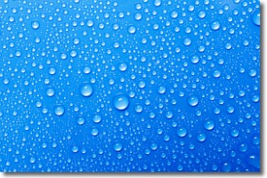
Weather Topic: What is Evaporation?
Home - Education - Precipitation - Evaporation
 Next Topic: Fog
Evaporation is the process which returns water from the earth
back to the atmosphere, and is another crucial process in the water cycle.
Evaporation is the transformation of liquid into gas, and it happens because
molecules are excited by the application of energy and turn into vapor.
In order for water to evaporate it has to be on the surface of a body of water.
Next Topic: Fog
Current conditions powered by WeatherAPI.com


