Weather Alert in Washington
Red Flag Warning issued August 27 at 9:21AM PDT until August 27 at 8:00PM PDT by NWS Seattle WA
AREAS AFFECTED: West Slopes of the North Cascades Generally above 1500 Feet; West Slopes of the Central Cascades Generally above 1500 Feet; East Portion of the Olympic Mountains
DESCRIPTION: * AFFECTED AREA...Fire Weather Zone 658 West Slopes of the North Cascades Generally above 1500 Feet, Fire Weather Zone 659 West Slopes of the Central Cascades Generally above 1500 Feet and Fire Weather Zone 661 East Portion of the Olympic Mountains. * THUNDERSTORMS...Thunderstorms are favored along the eastern slopes of the Olympic mountains between 11 AM and 3 PM, and more so in the Cascades from 3 PM to 8 PM. Wetting rains are possible, but lightning strikes on very dry fuel are capable of new fire starts. * OUTFLOW WINDS...Outflow winds of 25 to 30 mph are possible. Outflow winds can occur ahead of and behind storms and cause erratic wind directions. * IMPACTS...Scattered lightning in dry fuels can cause multiple fire starts. Thunderstorms can also bring sudden sharp wind shifts on existing fires, causing rapid changes in a fire's rate of spread and direction of spread. Thunderstorm outflow winds can be a threat for several hours following the start of a new lightning-caused fire. If a fire were to begin, air quality may diminish in the surrounding area. * THUNDERSTORMS...Multiple lightning strikes occurred in the higher terrain of the Cascades mountains yesterday afternoon and evening and that will resume this afternoon and evening. Multiple days in a row of lightning strikes on our dry fuels could result in a critical number of new wildfires.
INSTRUCTION: A Red Flag Warning means that critical fire weather conditions are either imminent or occurring now. Any fires that develop will likely spread quickly. Outdoor burning is not recommended.
Want more detail? Get the Complete 7 Day and Night Detailed Forecast!
Current U.S. National Radar--Current
The Current National Weather Radar is shown below with a UTC Time (subtract 5 hours from UTC to get Eastern Time).

National Weather Forecast--Current
The Current National Weather Forecast and National Weather Map are shown below.

National Weather Forecast for Tomorrow
Tomorrow National Weather Forecast and Tomorrow National Weather Map are show below.

North America Water Vapor (Moisture)
This map shows recent moisture content over North America. Bright and colored areas show high moisture (ie, clouds); brown indicates very little moisture present; black indicates no moisture.

Weather Topic: What is Snow?
Home - Education - Precipitation - Snow
 Next Topic: Stratocumulus Clouds
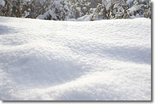
Snow is precipitation taking the form of ice crystals. Each ice crystal, or snowflake,
has unique characteristics, but all of them grow in a hexagonal structure.
Snowfall can last for sustained periods of time and result in significant buildup
of snow on the ground.
On the earth's surface, snow starts out light and powdery, but as it begins to melt
it tends to become more granular, producing small bits of ice which have the consistency of
sand. After several cycles of melting and freezing, snow can become very dense
and ice-like, commonly known as snow pack.
Next Topic: Stratocumulus Clouds
Weather Topic: What are Stratus Clouds?
Home - Education - Cloud Types - Stratus Clouds
 Next Topic: Wall Clouds
Stratus clouds are similar to altostratus clouds, but form at a
lower altitude and are identified by their fog-like appearance, lacking the
distinguishing features of most clouds.
Stratus clouds are wider than most clouds, and their base has a smooth, uniform
look which is lighter in color than a nimbostratus cloud.
The presence of a stratus cloud indicates the possibility of minor precipitation,
such as drizzle, but heavier precipitation does not typically arrive in the form
of a stratus cloud.
Next Topic: Wall Clouds
Current conditions powered by WeatherAPI.com


