Weather Alert in Michigan
Flood Warning issued April 2 at 10:49AM EDT until April 7 at 2:00AM EDT by NWS Gaylord MI
AREAS AFFECTED: Wexford, MI
DESCRIPTION: ...The National Weather Service in Gaylord MI has issued a Flood Warning for the following rivers in Michigan... Manistee River near Sherman affecting Wexford County. For the Manistee River...including Sherman...Minor flooding is forecast. * WHAT...Minor flooding is forecast. This approaches the flood of record. * WHERE...Manistee River near Sherman. * WHEN...From late tonight to early Tuesday morning. * IMPACTS...At 16.0 feet, Flooding of property and homes adjacent to right bank of river along Ojibway Drive, Ottawa Drive, and Chippewa Drive 1 mile north of Sherman. Flooding of N11 Road between W14 Road and W16 Road 1 mile northwest of Mesick. * ADDITIONAL DETAILS... - At 10:30 AM EDT Thursday the stage was 14.6 feet. - Bankfull stage is 14.0 feet. - Forecast...The river is expected to rise above flood stage just after midnight tonight to a crest of 15.9 feet Saturday morning. It will then fall below flood stage Monday evening. - Flood stage is 15.0 feet. - Flood History...This crest compares to a previous crest of 16.0 feet on 03/18/1990. - http://www.weather.gov/safety/flood
INSTRUCTION: Turn around, don't drown when encountering flooded roads. Most flood deaths occur in vehicles. Additional information is available at www.weather.gov. The next statement will be issued by Friday morning at 1100 AM EDT.
Want more detail? Get the Complete 7 Day and Night Detailed Forecast!
Current U.S. National Radar--Current
The Current National Weather Radar is shown below with a UTC Time (subtract 5 hours from UTC to get Eastern Time).

National Weather Forecast--Current
The Current National Weather Forecast and National Weather Map are shown below.

National Weather Forecast for Tomorrow
Tomorrow National Weather Forecast and Tomorrow National Weather Map are show below.

North America Water Vapor (Moisture)
This map shows recent moisture content over North America. Bright and colored areas show high moisture (ie, clouds); brown indicates very little moisture present; black indicates no moisture.

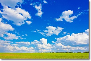
Weather Topic: What are Cumulus Clouds?
Home - Education - Cloud Types - Cumulus Clouds
 Next Topic: Drizzle
Cumulus clouds are fluffy and textured with rounded tops, and
may have flat bottoms. The border of a cumulus cloud
is clearly defined, and can have the appearance of cotton or cauliflower.
Cumulus clouds form at low altitudes (rarely above 2 km) but can grow very tall,
becoming cumulus congestus and possibly the even taller cumulonimbus clouds.
When cumulus clouds become taller, they have a greater chance of producing precipitation.
Next Topic: Drizzle
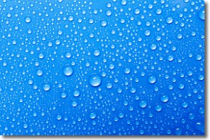
Weather Topic: What is Evaporation?
Home - Education - Precipitation - Evaporation
 Next Topic: Fog
Evaporation is the process which returns water from the earth
back to the atmosphere, and is another crucial process in the water cycle.
Evaporation is the transformation of liquid into gas, and it happens because
molecules are excited by the application of energy and turn into vapor.
In order for water to evaporate it has to be on the surface of a body of water.
Next Topic: Fog
Current conditions powered by WeatherAPI.com


