Weather Alert in New Mexico
Flash Flood Warning issued September 6 at 4:09PM MDT until September 6 at 6:30PM MDT by NWS El Paso Tx/Santa Teresa NM
AREAS AFFECTED: Otero, NM
DESCRIPTION: FFWEPZ The National Weather Service in El Paso Tx/Santa Teresa has issued a * Flash Flood Warning for... The Seven Springs Fire Burn Scar in... North Central Otero County in south central New Mexico... * Until 630 PM MDT. * At 409 PM MDT, Doppler radar indicated thunderstorms producing heavy rain over the Seven Springs Fire Burn Scar. Between 0.5 and 1 inch of rain has fallen. Additional rainfall amounts up to 0.5 inches are possible in the warned area. Flash flooding is ongoing or expected to begin shortly. Excessive rainfall over the burn scar will result in debris flow moving through the Seven Springs Fire Burn Scar and downstream through Nogal Canyon. The debris flow can consist of rock, mud, vegetation and other loose materials. HAZARD...Flash flooding caused by thunderstorms in and around the Seven Springs Fire Burn Scar. SOURCE...Radar. IMPACT...Flooding of areas in and around the Seven Springs Fire Burn Scar. * Some locations that will experience flash flooding include... Upper Nogal Canyon.
INSTRUCTION: This is a life threatening situation. Heavy rainfall will cause extensive and severe flash flooding of creeks...streams...and ditches in the Seven Springs Fire Burn Scar. Severe debris flows can also be anticipated across roads. Roads and driveways may be washed away in places. If you encounter flood waters...climb to safety.
Want more detail? Get the Complete 7 Day and Night Detailed Forecast!
Current U.S. National Radar--Current
The Current National Weather Radar is shown below with a UTC Time (subtract 5 hours from UTC to get Eastern Time).

National Weather Forecast--Current
The Current National Weather Forecast and National Weather Map are shown below.

National Weather Forecast for Tomorrow
Tomorrow National Weather Forecast and Tomorrow National Weather Map are show below.

North America Water Vapor (Moisture)
This map shows recent moisture content over North America. Bright and colored areas show high moisture (ie, clouds); brown indicates very little moisture present; black indicates no moisture.

Weather Topic: What is Drizzle?
Home - Education - Precipitation - Drizzle
 Next Topic: Evaporation
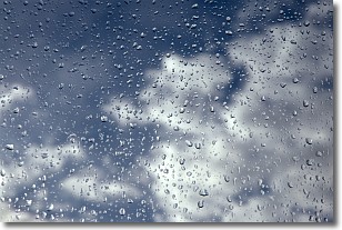
Drizzle is precipitation in the form of water droplets which are
smaller than raindrops.
Drizzle is characterized by fine, gently falling droplets and typically does not
impact human habitation in a negative way. The exception to this is freezing drizzle,
a condition where drizzle freezes immediately upon reaching earth's surface.
Freezing drizzle is still less dangerous than freezing rain, but can
potentially result in hazardous road conditions.
Next Topic: Evaporation
Weather Topic: What is Fog?
Home - Education - Cloud Types - Fog
 Next Topic: Fractus Clouds
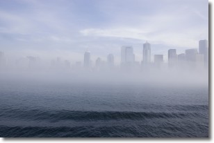
Fog is technically a type of stratus cloud, which lies along the
ground and obscures visibility.
It is usually created when humidity in the air condenses into tiny water droplets.
Because of this, some places are more prone to foggy weather, such as regions
close to a body of water.
Fog is similar to mist; both are the appearance of water droplets suspended in
the air, but fog is the term applied to the condition when visibility is less than 1 km.
Next Topic: Fractus Clouds
Current conditions powered by WeatherAPI.com


