Weather Alert in Kansas
Red Flag Warning issued February 16 at 1:45PM MST until February 17 at 8:00PM MST by NWS Goodland KS
AREAS AFFECTED: Decatur; Norton; Thomas; Sheridan; Graham; Logan; Gove; Wichita; Red Willow
DESCRIPTION: For Tuesday, low relative humidity and sustained winds around 40 mph will lead to extreme fire spread for any fires that ignite. Southwest winds will change to west behind a cold front in the afternoon. Blowing dust may also occur near open fields or other source regions causing reductions in visibility and poor air quality. * AFFECTED AREA...Fire Weather Zones 003 Decatur, 004 Norton, 014 Thomas, 015 Sheridan, 016 Graham, 028 Logan, 029 Gove, 042 Wichita and 081 Red Willow. * TIMING...From 11 AM to 9 PM CST Tuesday. * WINDS...West 30 to 40 mph with gusts up to 60 mph. * RELATIVE HUMIDITY...As low as 10 percent. * IMPACTS...Extremely dangerous and erratic fire behavior. Any fires that develop will rapidly grow and spread out of control.
INSTRUCTION: Comply with burn bans and regulations. Avoid driving on dry grass or brush. Maintain vehicle brakes and tires and secure tow chains to avoid dragging. Never toss lit cigarettes onto the ground. Evacuate if fire/smoke is heading your way, or if ordered to do so by local officials.
Want more detail? Get the Complete 7 Day and Night Detailed Forecast!
Current U.S. National Radar--Current
The Current National Weather Radar is shown below with a UTC Time (subtract 5 hours from UTC to get Eastern Time).

National Weather Forecast--Current
The Current National Weather Forecast and National Weather Map are shown below.

National Weather Forecast for Tomorrow
Tomorrow National Weather Forecast and Tomorrow National Weather Map are show below.

North America Water Vapor (Moisture)
This map shows recent moisture content over North America. Bright and colored areas show high moisture (ie, clouds); brown indicates very little moisture present; black indicates no moisture.

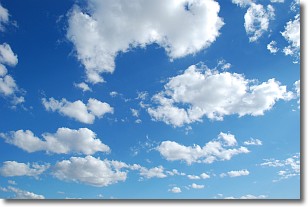
Weather Topic: What are Cumulonimbus Clouds?
Home - Education - Cloud Types - Cumulonimbus Clouds
 Next Topic: Cumulus Clouds
The final form taken by a growing cumulus cloud is the
cumulonimbus cloud, which is very tall and dense.
The tower of a cumulonimbus cloud can soar 23 km into the atmosphere, although
most commonly they stop growing at an altitude of 6 km.
Even small cumulonimbus clouds appear very large in comparison to other cloud types.
They can signal the approach of stormy weather, such as thunderstorms or blizzards.
Next Topic: Cumulus Clouds
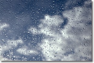
Weather Topic: What is Drizzle?
Home - Education - Precipitation - Drizzle
 Next Topic: Evaporation
Drizzle is precipitation in the form of water droplets which are
smaller than raindrops.
Drizzle is characterized by fine, gently falling droplets and typically does not
impact human habitation in a negative way. The exception to this is freezing drizzle,
a condition where drizzle freezes immediately upon reaching earth's surface.
Freezing drizzle is still less dangerous than freezing rain, but can
potentially result in hazardous road conditions.
Next Topic: Evaporation
Current conditions powered by WeatherAPI.com


