Weather Alert in Oregon
Heat Advisory issued September 1 at 2:22PM PDT until September 3 at 9:00PM PDT by NWS Portland OR
AREAS AFFECTED: West Columbia River Gorge I-84 Corridor; Upper Hood River Valley; Central Columbia River Gorge I-84 Corridor; West Columbia River Gorge - SR 14; Central Columbia River Gorge - SR 14
DESCRIPTION: * WHAT...Afternoon high temperatures in the mid to upper 90s and overnight low temperatures in the mid 60s to lower 70s expected. * WHERE...Western and Central Columbia River Gorge and the Hood River Valley. * WHEN...From noon Tuesday to 9 PM PDT Wednesday. * IMPACTS...Hot temperatures may cause heat illnesses. * ADDITIONAL DETAILS...Increasing high clouds may limit high temperatures a bit on Wednesday when compared to Tuesday. However, probabilities for high temperatures above 90 degrees on Wednesday are high, ranging from 80-90%.
INSTRUCTION: Drink plenty of fluids, stay in a cool place during the heat of the day, stay out of the sunshine, and check up on relatives and neighbors. For those without air conditioning, use fans to keep air moving. Keeps windows closed during the day and open at night, unless air quality is degraded due to wildfire smoke. Take extra precautions when outside. Wear lightweight and loose fitting clothing. Try to limit strenuous activities to early morning or evening. Take action when you see symptoms of heat exhaustion and heat stroke. Do not leave young children and pets in unattended vehicles. Car interiors will reach lethal temperatures in a matter of minutes.
Want more detail? Get the Complete 7 Day and Night Detailed Forecast!
Current U.S. National Radar--Current
The Current National Weather Radar is shown below with a UTC Time (subtract 5 hours from UTC to get Eastern Time).

National Weather Forecast--Current
The Current National Weather Forecast and National Weather Map are shown below.

National Weather Forecast for Tomorrow
Tomorrow National Weather Forecast and Tomorrow National Weather Map are show below.

North America Water Vapor (Moisture)
This map shows recent moisture content over North America. Bright and colored areas show high moisture (ie, clouds); brown indicates very little moisture present; black indicates no moisture.

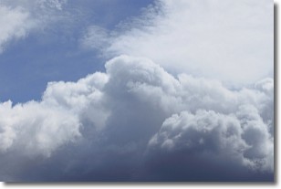
Weather Topic: What are Nimbostratus Clouds?
Home - Education - Cloud Types - Nimbostratus Clouds
 Next Topic: Precipitation
A nimbostratus cloud is similar to a stratus cloud in its formless,
smooth appearance. However, a nimbostratus cloud is darker than a stratus cloud,
because it is thicker.
Unlike a stratus cloud, a nimbostratus cloud typically brings with it the threat
of moderate to heavy precipitation. In some cases, the precipitation may evaporate
before reaching the ground, a phenomenon known as virga.
Next Topic: Precipitation
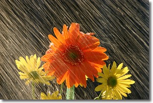
Weather Topic: What is Rain?
Home - Education - Precipitation - Rain
 Next Topic: Shelf Clouds
Precipitation in the form of water droplets is called rain.
Rain generally has a tendency to fall with less intensity over a greater period
of time, and when rainfall is more severe it is usually less sustained.
Rain is the most common form of precipitation and happens with greater frequency
depending on the season and regional influences. Cities have been shown to have
an observable effect on rainfall, due to an effect called the urban heat island.
Compared to upwind, monthly rainfall between twenty and forty miles downwind of
cities is 30% greater.
Next Topic: Shelf Clouds
Current conditions powered by WeatherAPI.com


