Weather Alert in Wisconsin
Winter Weather Advisory issued April 1 at 3:11AM CDT until April 2 at 12:00PM CDT by NWS Twin Cities/Chanhassen MN
AREAS AFFECTED: Polk; Barron; Rusk
DESCRIPTION: ...MESSY SPRING SYSTEM BRINGS FREEZING RAIN, SLEET, AND SNOWTO PORTIONS OF MINNESOTA AND WISCONSIN TONIGHT THROUGH THURSDAY... .A strong spring system brings a variety of precipitation types to the region tonight through Thursday. While there is still some uncertainty in the exact track of the low, mainly snow & sleet is expected across central Minnesota, while a mix of freezing rain, sleet, & snow is expected for southern Minnesota, the Twin Cities metro, & western Wisconsin. The greatest travel impacts are expected across eastern Minnesota & west-central Wisconsin where icing amounts around 0.25" are likely, along with sleet & snow at times. This will lead to very slick roads, as well as the possibility of some downed tree branches & power outages. Elsewhere, freezing rain accumulations around 0.1" along with an inch or two of sleet & snow will lead to slick roads late Wednesday night through Thursday morning. * WHAT...Mixed precipitation expected. Total snow accumulations up to one inch, sleet accumulations around 1 inch, and ice accumulations between one tenth and two tenths of an inch. * WHERE...Barron, Polk, and Rusk Counties. * WHEN...From midnight tonight to noon CDT Thursday. * IMPACTS...Roads, and especially bridges and overpasses, will likely become slick and hazardous. Plan on slippery road conditions. The hazardous conditions will impact the Wednesday evening and Thursday morning commutes.
INSTRUCTION: Slow down and use caution while traveling. Call 5 1 1 or visit 511wi.gov for road conditions.
Want more detail? Get the Complete 7 Day and Night Detailed Forecast!
Current U.S. National Radar--Current
The Current National Weather Radar is shown below with a UTC Time (subtract 5 hours from UTC to get Eastern Time).

National Weather Forecast--Current
The Current National Weather Forecast and National Weather Map are shown below.

National Weather Forecast for Tomorrow
Tomorrow National Weather Forecast and Tomorrow National Weather Map are show below.

North America Water Vapor (Moisture)
This map shows recent moisture content over North America. Bright and colored areas show high moisture (ie, clouds); brown indicates very little moisture present; black indicates no moisture.

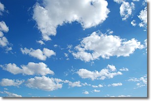
Weather Topic: What are Cumulonimbus Clouds?
Home - Education - Cloud Types - Cumulonimbus Clouds
 Next Topic: Cumulus Clouds
The final form taken by a growing cumulus cloud is the
cumulonimbus cloud, which is very tall and dense.
The tower of a cumulonimbus cloud can soar 23 km into the atmosphere, although
most commonly they stop growing at an altitude of 6 km.
Even small cumulonimbus clouds appear very large in comparison to other cloud types.
They can signal the approach of stormy weather, such as thunderstorms or blizzards.
Next Topic: Cumulus Clouds
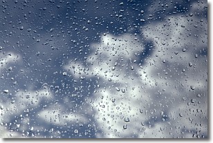
Weather Topic: What is Drizzle?
Home - Education - Precipitation - Drizzle
 Next Topic: Evaporation
Drizzle is precipitation in the form of water droplets which are
smaller than raindrops.
Drizzle is characterized by fine, gently falling droplets and typically does not
impact human habitation in a negative way. The exception to this is freezing drizzle,
a condition where drizzle freezes immediately upon reaching earth's surface.
Freezing drizzle is still less dangerous than freezing rain, but can
potentially result in hazardous road conditions.
Next Topic: Evaporation
Current conditions powered by WeatherAPI.com


