Weather Alert in California
Special Weather Statement issued February 16 at 10:13AM PST by NWS Los Angeles/Oxnard CA
AREAS AFFECTED: Santa Clarita Valley; Ventura County Beaches; Ventura County Inland Coast; Central Ventura County Valleys; Malibu Coast; Western Santa Monica Mountains Recreational Area; Eastern Santa Monica Mountains Recreational Area; Calabasas and Agoura Hills; Western San Fernando Valley; Southeastern Ventura County Valleys; Santa Susana Mountains
DESCRIPTION: At 1013 AM PST, Doppler radar was tracking strong thunderstorms along a line extending from Malibu to 18 miles northwest of Two Harbors. Movement was east at 30 mph. HAZARD...Wind gusts up to 55 mph. SOURCE...Radar indicated. IMPACT...Gusty winds could knock down tree limbs and blow around unsecured objects. Locations impacted include... Thousand Oaks... Simi Valley... Camarillo... Encino... Chatsworth... Woodland Hills... Malibu... Agoura Hills... Northridge... Van Nuys... Moorpark... Point Mugu State Park... Calabasas... Newbury Park... Pacific Palisades... Porter Ranch... Topanga State Park... Point Mugu... Granada Hills... and Westlake Village.
INSTRUCTION: If outdoors, consider seeking shelter inside a building. Torrential rainfall is also occurring with these storms and may lead to localized flooding. Do not drive your vehicle through flooded roadways.
Want more detail? Get the Complete 7 Day and Night Detailed Forecast!
Current U.S. National Radar--Current
The Current National Weather Radar is shown below with a UTC Time (subtract 5 hours from UTC to get Eastern Time).

National Weather Forecast--Current
The Current National Weather Forecast and National Weather Map are shown below.

National Weather Forecast for Tomorrow
Tomorrow National Weather Forecast and Tomorrow National Weather Map are show below.

North America Water Vapor (Moisture)
This map shows recent moisture content over North America. Bright and colored areas show high moisture (ie, clouds); brown indicates very little moisture present; black indicates no moisture.

Weather Topic: What is Drizzle?
Home - Education - Precipitation - Drizzle
 Next Topic: Evaporation
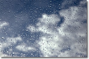
Drizzle is precipitation in the form of water droplets which are
smaller than raindrops.
Drizzle is characterized by fine, gently falling droplets and typically does not
impact human habitation in a negative way. The exception to this is freezing drizzle,
a condition where drizzle freezes immediately upon reaching earth's surface.
Freezing drizzle is still less dangerous than freezing rain, but can
potentially result in hazardous road conditions.
Next Topic: Evaporation
Weather Topic: What is Fog?
Home - Education - Cloud Types - Fog
 Next Topic: Fractus Clouds
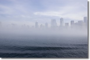
Fog is technically a type of stratus cloud, which lies along the
ground and obscures visibility.
It is usually created when humidity in the air condenses into tiny water droplets.
Because of this, some places are more prone to foggy weather, such as regions
close to a body of water.
Fog is similar to mist; both are the appearance of water droplets suspended in
the air, but fog is the term applied to the condition when visibility is less than 1 km.
Next Topic: Fractus Clouds
Current conditions powered by WeatherAPI.com


